Site Assessment
Layering information to facilitate decision-making
a Field Journal Essay by Tom T. Young
the Sustainable SITES Series
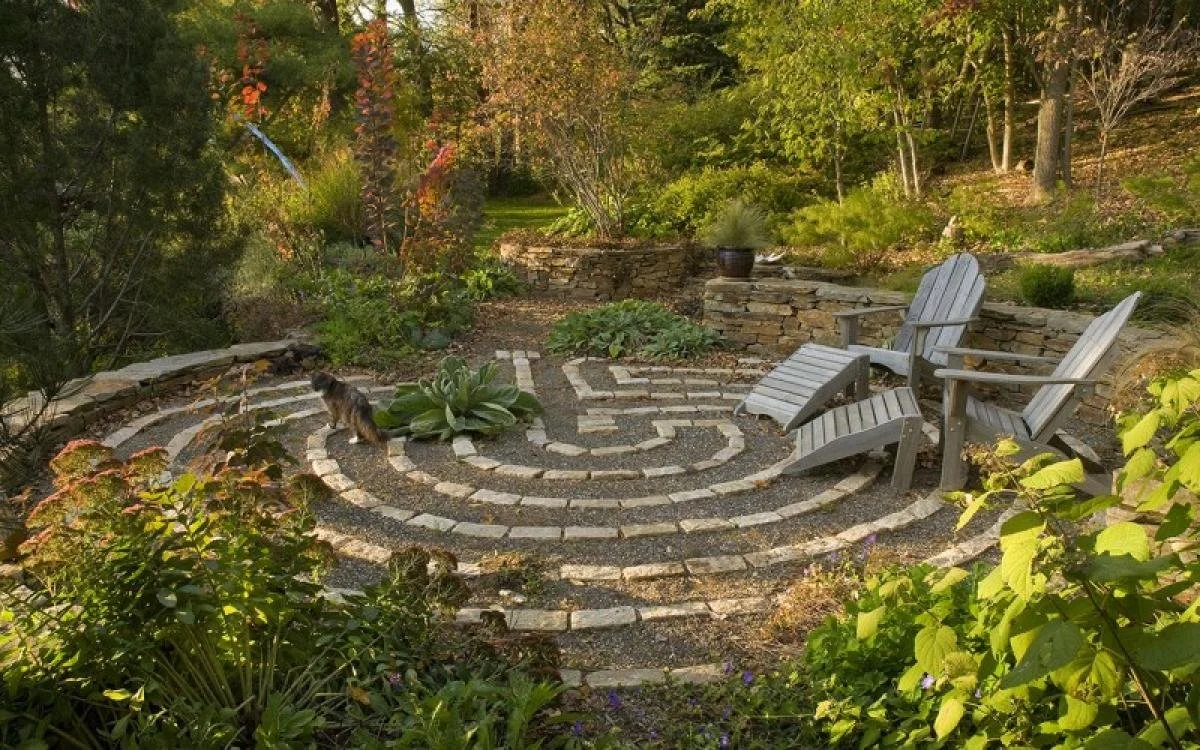
Taylor Residence (SITES™ Accredited Landscape)
About SITES
This series unpacks elements of the Sustainable Sites Initiative (SITES™), which grew out of the same framework as USGBC’s LEED green building certification. This rating system evaluates the performance of a landscape site (anything from the building ‘skin’ outward) and accredits those that fulfill requirements and achieve a certain number of points.
“By aligning land design and development practices with functions of healthy ecosystems, the SITES™ program demonstrates how the work of developers, property owners, landscape architects… can protect, restore, and enhance ecosystem services.” (SITES™ v2 Reference Guide)
“Ecosystem services are goods and services of direct or indirect benefit to humans that are produced by ecosystem processes that involve the interactions of living elements, such as vegetation and soil organisms, and non-living elements such as bedrock, water, and air.” (SITES™)
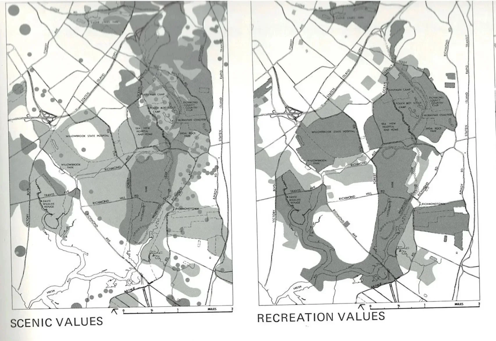
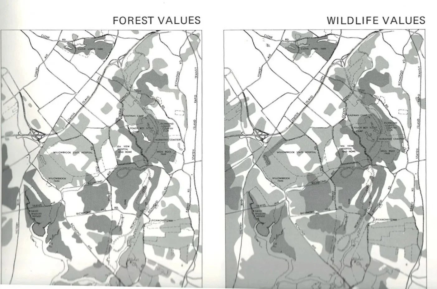
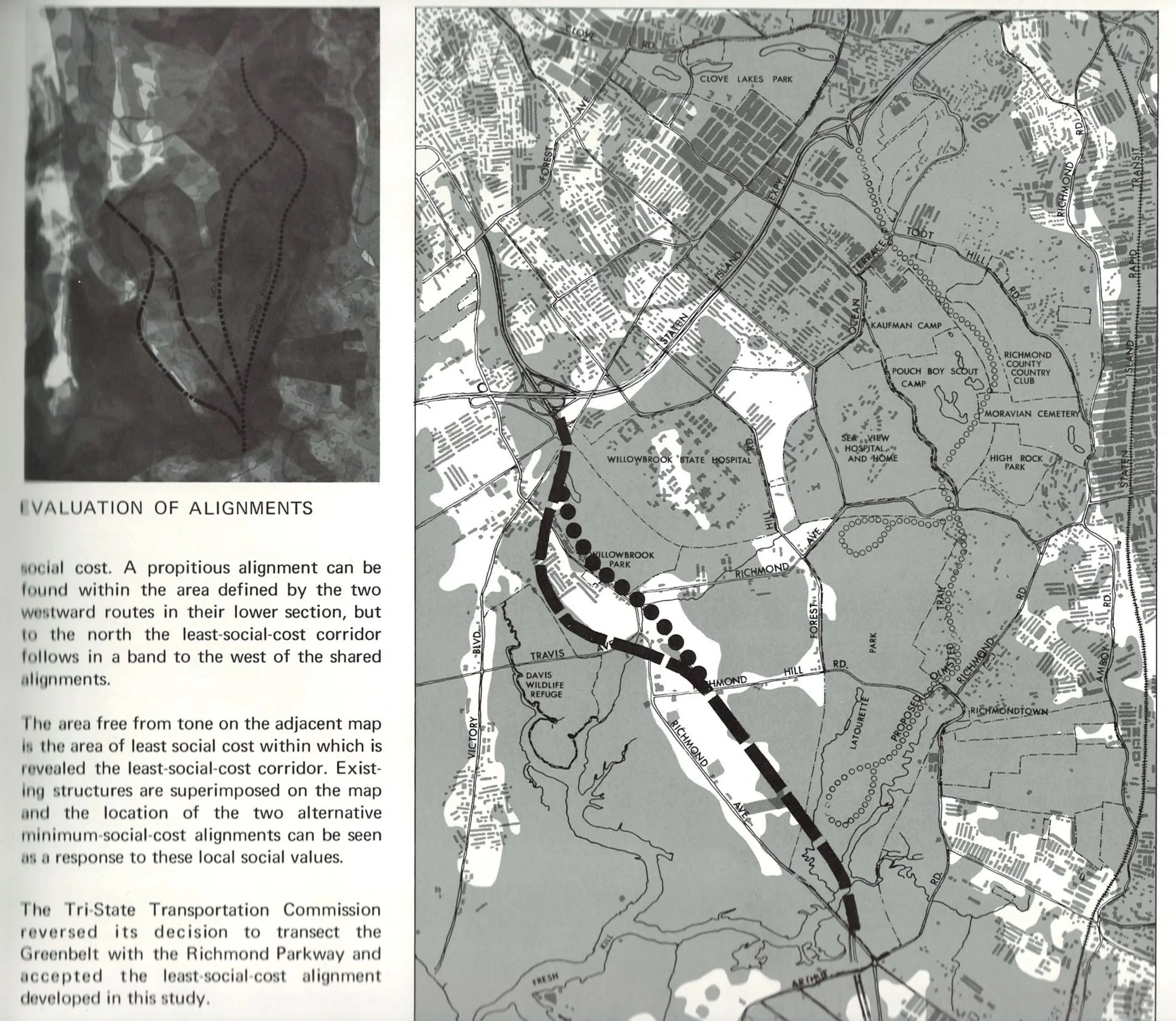
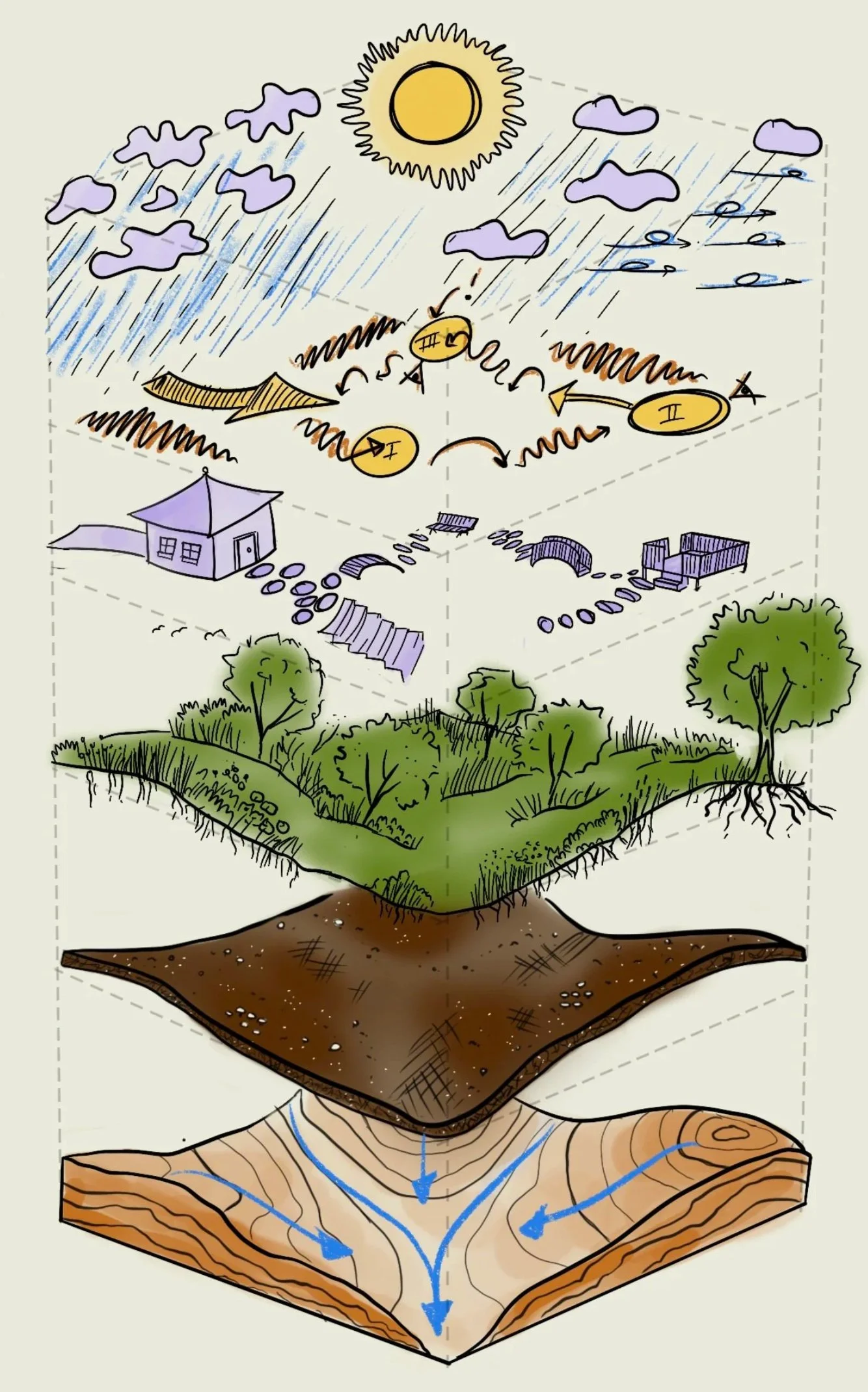
A Layered Approach
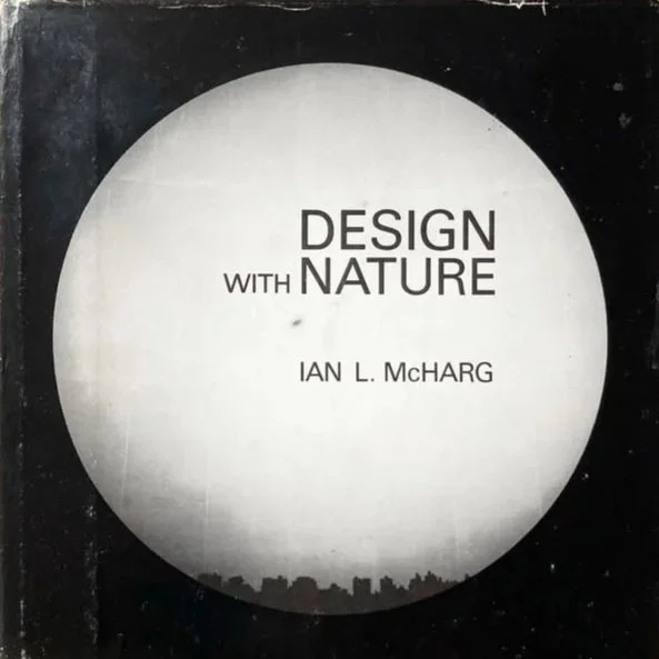
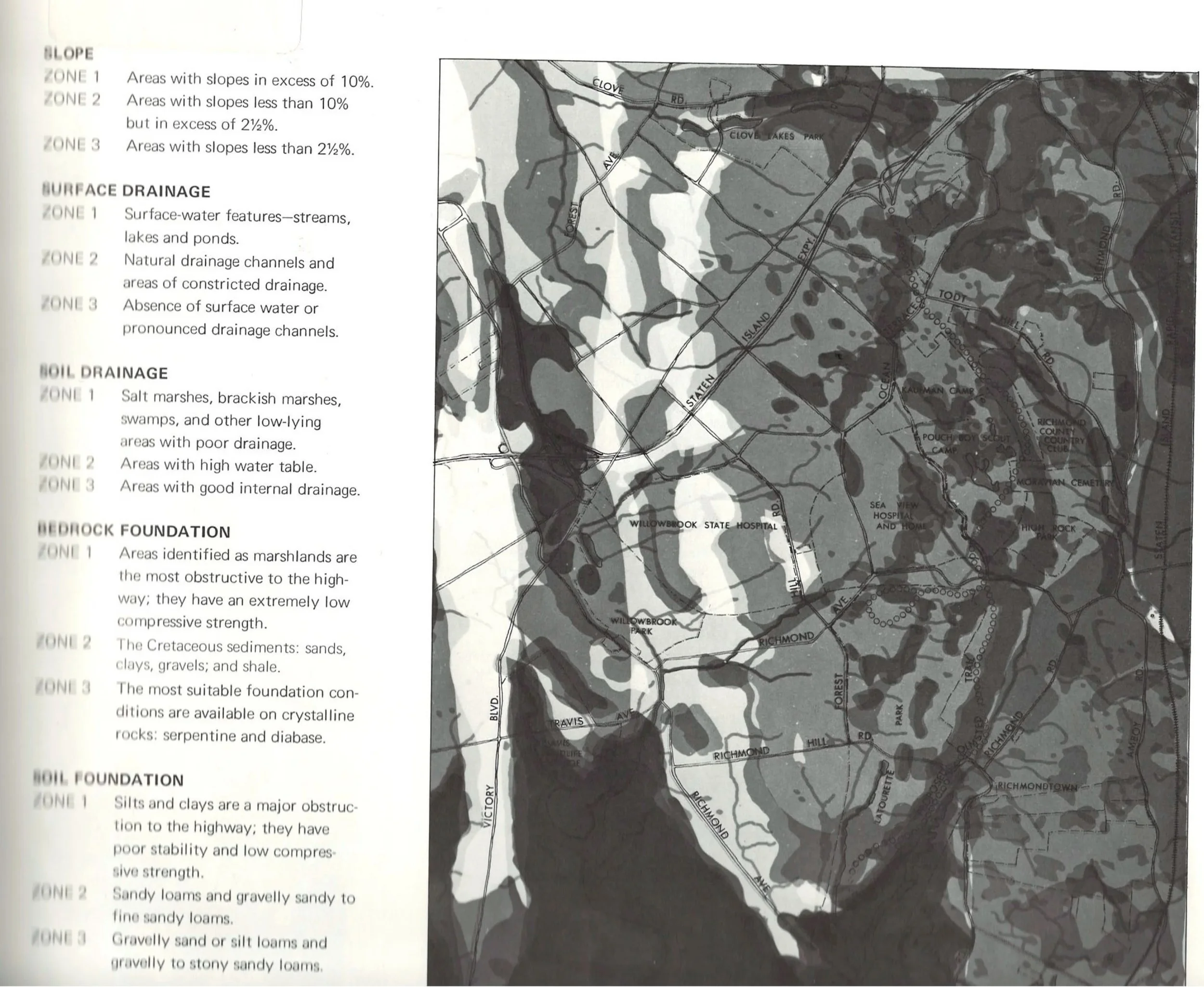
Ian McHarg, a Scottish landscape architect born in 1920, is widely considered one of the foundationalists for the environmental movement. In particular, he popularized tactics for ecological and regional planning with his book Design With Nature (1969), the principles of which would later set the stage for geographic information systems (GIS).
McHarg asserts, among many brilliant concepts, that the best way for us to plan and design is with the course and energy flows of nature, not against. In order to make sustainable use of the land’s bounties, we must first understand its characteristics and relationships. Design With Nature unfolds with beautiful maps that layer information to reveal a hidden solution based on the requirements of whatever it is that you’re trying to build. This multi-dimensional information allows us to make prudent decisions that work with the land and its residents. McHarg puts it best:
“If one accepts the simple proposition that nature is the arena of life and that a modicum of knowledge of her processes is indispensable for survival and rather more for existence, health and delight, it is amazing how many apparently difficult problems present ready resolution.”
Ian McHarg (Design With Nature, 1969)
You don’t need to pursue SITES™ accreditation in order to begin your journey in better understanding the land around you (although let us know if you’re interested!).
The following unpacks Sustainable Sites Initiative prerequisite P2.2 Conduct pre-design site assessment, under Section 2: Pre-design Assessment + Planning. Every SITES™ accredited landscape must collect and assess information from the site to help identify opportunities for ecological improvement and connectivity. By combining this critical analysis with an integrative design team, this process results in a bespoke and beautiful solution while cutting down on overall project friction.
Conduct a Pre-design Site Assessment
In order to achieve SITES™ accreditation, a landscape intervention must (among a few other prerequisites) maximize the opportunities for beneficial site performance by conducting an accurate and detailed assessment of site conditions and exploring options for sustainable outcomes prior to design. Each project must map existing site conditions and resources, collect information about surrounding areas (including non-physical influences like policy), and explain how this information will influence the sustainable design.
While the SITES™ checklist is rather technical and long (see below for an overview), the general concepts of this prerequisite can be attributed in part to McHarg’s layered approach to analysis. Here at Design Ecosystems, we apply this same principle to all of the landscapes we design, as it helps us get a holistic understanding of the land, its challenges, and opportunities.
When we take inventory of a site, we bring with us a few tools to help us document qualitative and quantitative data. The simple but mighty measuring tape helps us grab the dimensions of buildings, locations of trees, heights of windows, and square footage of beds or hardscape. We use a surveying transit level tool to measure the slope of the hills and valleys throughout the site. A soil probe allows us to check moisture, pH, nutrient, and light levels at various test points. We use maps and datasheets to collect data points and notes from our clients and observations.
To capture the look and feel of the place, we take photos and videos with cameras and a drone. Multiple scales and angles of the landscape are used to create a composite understanding of the place, and to reference as we continue into the design process. We even use a clever app that allows us to scan our surroundings with a phone and create a 3D model for us to bring into rendering software.

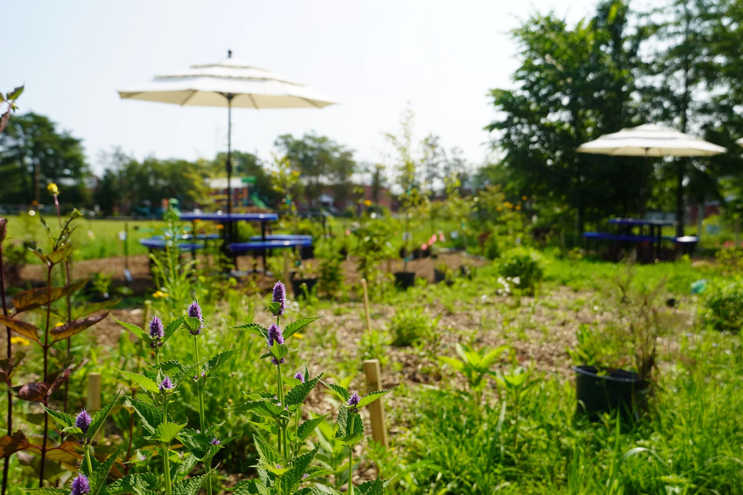
Assessing the native vegetation in the outdoor classroom meadow we co-designed with a 5th-grade STEAM class.
To continue the analysis, we take all of this information back to our desks and begin digitizing existing conditions maps. We also research through trusted sources to uncover additional site information, like land history, sun and precipitation data, zoning, reference ecoregion/habitat, and surrounding context.
Wrapped up in a comprehensive presentation deck, we walk our clients through our findings, so that we all share an understanding of the land and the vision for its design.
What We Collect
The SITES™ submission checklist is comprehensive and cross-references with prerequisites and credits that you can achieve throughout the design process. For example, every project is required to locate and design in consideration with the 100-year floodplain, and the checklist requires that you map the FEMA 100-year floodplain line onto the existing conditions plan.
Every landscape is different, and we at Design Ecosystems have our own methodology of site inventory and analysis that is influenced by the Sustainable Sites Initiative, the Audubon Society (H.E.L.P.), and many other experts in the field. The following unpacks elements of the SITES™ assessment checklist, summarized and presented from the ground up.
Land & Water. Water flows downhill, taking the path of least resistance. The shape of the land tells us how water moves, how wind and sound travel, what plants grow, and how animals find their niche. We start by observing and measuring the topography of the land, which gives us many clues as to what we should put where. In addition to mapping the 100-year floodplain, we map existing aquatic ecosystems, wetland, shoreline, riparian buffers, artificial streams or channels, overland water, and pollution sources. These, along with understanding historic precipitation and watershed conditions paint an accurate picture of how water filters and moves through this place. >> Managing Precipitation on Site
Soil. Soil is where plant roots uptake water and nutrients, and where complex relationships between invertebrates, fungi, plants, and microorganisms coincide. Soil is made up of small inorganic particles (sand, silt, clay) along with organic matter, living things, and air. We can measure the presence or absence of all these elements, along with soil characteristics such as compaction/infiltration, pH, and chemical composition. By comparing the existing soil to a reference sample (soils native to that site), we can determine if the soil is healthy and should be preserved, or it was disturbed by development and requires remediation. >> USDA Web Soil Survey
Vegetation. Plants bring countless benefits to the landscape: they provide habitat for local animals, support water uptake and filtration, and produce food and medicine for their human neighbors. By understanding the existing plants and associated communities, we can determine the best course of action for which plants to leave alone, which to remove, and which to add. Mapping habitat for threatened and endangered species, existing vegetated areas, invasive plants, native plants and reference communities, and appropriate plants for the site provide critical information to decide what gets planted where to support as many ecosystem services as possible. >> Dense, Layered, Native Planting
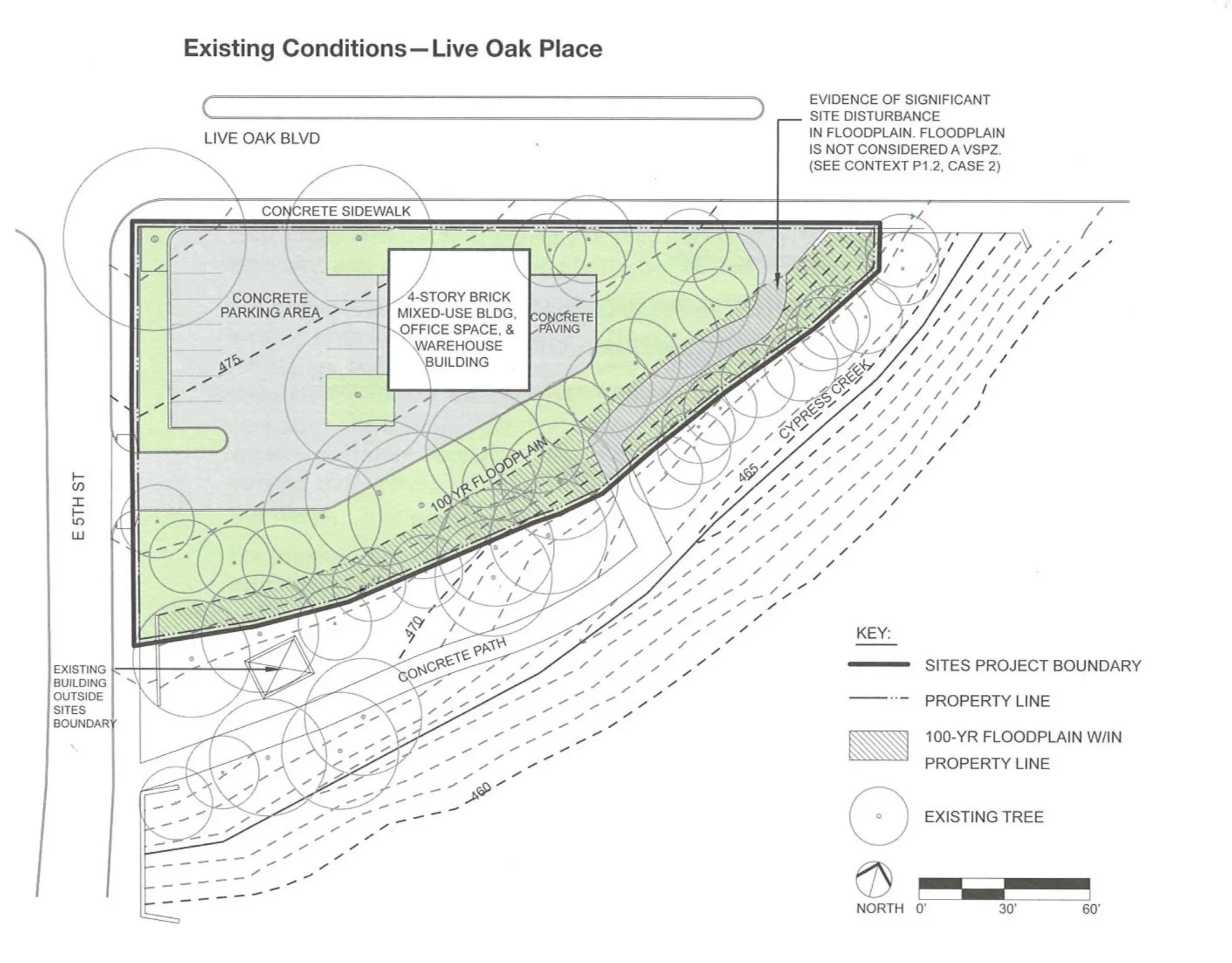
Example of a SITES™ existing conditions plan
Structures. Nearly any predeveloped landscape will have some existing structures and materials. Whether it’s buildings, hardscape materials, fencing, furniture, utilities, or art, inventorying what you have on site, what can be retained/salvaged/recycled, and how to reduce waste going to landfill will promote a more sustainable and often more unique design. SITES™ encourages the sourcing of sustainable materials by promoting suppliers of salvaged, recycled, responsibly extracted, chemically safer, and local materials and labor.
Use. A well-designed site will embody both beauty, function, and use all in one. Not only do we observe and discuss human uses of the site (rest, recreation, food production), we strive to understand how animals of all shapes and sizes can use the landscape, too. For humans, we map access to basic services, historic buildings and cultural landscapes, unique site features, and who is anticipated to frequent the site in the future. For habitat, we rely on resources like the EPA Level III Ecoregions, the IUCN Red list of Threatened Species, and literature on native plant communities to provide as much shelter, food, and resources for the next generation as possible.
Climate. We finally take all the world’s environmental rhythms into consideration. From the sun and how it travels across the sky, to the shade it casts when it hits buildings and trees. From the rain and how it flows to how it's held as it reenters the water cycle. From wind and sound to hazards like fire and flood. These elements make up the climate of a site, which can change fairly dramatically across sites and time frames at any scale. A south-facing dry meadow will host quite different plants from the wet and shaded north side of a home. These are the nuances we aim to understand to make a design that works with the realities of nature.
Getting Started
The land has endless stories to share, we just need to listen for them.
Take measurements and impressions of the landscape.
Analyze data to gain information about its nature and tendencies.
Interpret into design knowledge to create strong, sustainable interventions.
If you’re stuck along the way, reach out and we’ll jump right in.
Opportunity is in every landscape.
From the ground up,
Design Ecosystems with us.
Check out other related essays from our Sustainable SITES Series